Why Egypt is racing to map its hidden mineral wealth after four decades
Egypt has launched its first comprehensive nationwide aerial mining survey in more than four decades, in a move officials say could reshape the country’s mineral sector and attract fresh foreign investment into one of Africa’s largest economies.
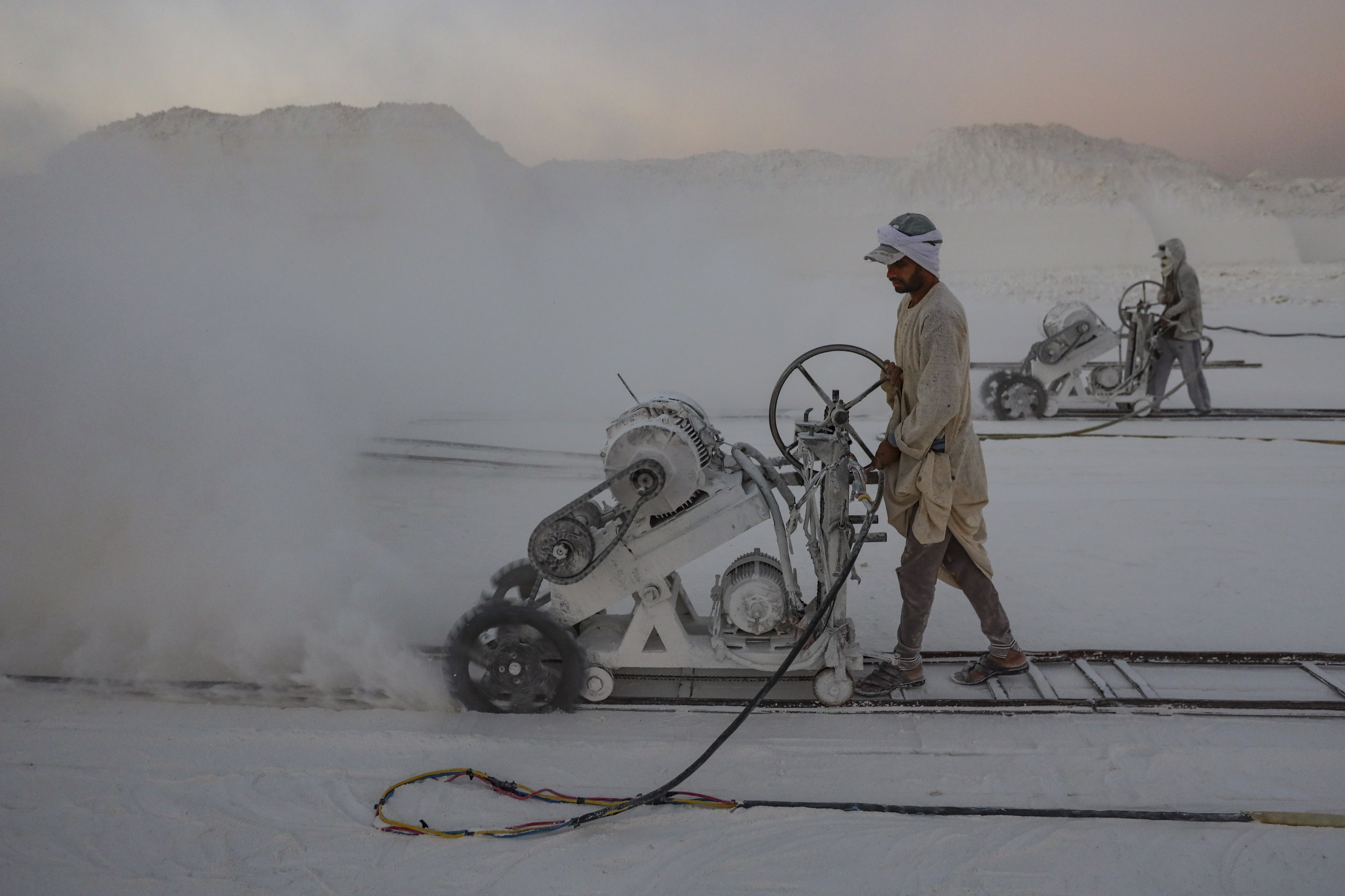
![Labourers work at the ''White Mountain'' limestone extraction quarry site near Minya, Egypt, on December 14, 2024. [Photo by Mahmoud Elkhwas/NurPhoto via Getty Images]](https://ocdn.eu/pulscms/MDA_/19a539139f90f1527e39d4450db05da2.jpg)
Egypt has launched its first comprehensive nationwide aerial mining survey in more than four decades, in a move officials say could reshape the country’s mineral sector and attract fresh foreign investment into one of Africa’s largest economies.
- Egypt has launched its first comprehensive aerial mining survey in more than four decades.
- The government says the project could unlock new mineral discoveries and attract foreign investment.
- Spanish company X-Calibre will lead the survey using advanced aircraft and geophysical technology.
- Officials believe updated mining data could reduce exploration risks and strengthen Egypt’s mining sector reforms.
The project, described by the government as one of the country’s most strategic mining initiatives in recent years, will use advanced aircraft and geophysical technologies to map Egypt’s mineral wealth across six major regions, including the Eastern Desert, Sinai, and parts of the Western Desert.
The initial contract for the survey was signed at Marsa Alam Airport in the presence of Egypt’s Minister of Petroleum and Mineral Resources, Eng. Karim Badawi, alongside senior government officials and representatives of the Spanish geophysical company X-Calibre.
But beyond the ceremonial signing lies a much bigger ambition: Egypt wants to position itself as a more competitive mining destination as global demand for critical minerals accelerates.
“This is the first comprehensive aerial mining survey conducted in Egypt in 42 years,” Badawi said during the signing ceremony.
He said the project would generate a modern, highly accurate mining database that would help investors identify commercially viable mineral deposits faster and with lower exploration risk.
For years, mining investors in Egypt have complained about outdated geological data, lengthy exploration processes, and high operational uncertainty. Officials now hope the new survey could change that equation.
The government believes better geological mapping could significantly reduce exploration costs while improving investor confidence in Egypt’s untapped mineral resources.
The survey will be carried out by X-Calibre in cooperation with Egypt’s Nuclear Materials Authority and local technology company Drone Tech. Officials said the project would combine international expertise with local scientific and technical capabilities.
According to geologist Yasser Ramadan, chairman of Egypt’s Minerals and Mining Industries Authority, the survey will cover six major geographical zones, including northern and southern sections of both the Eastern and Western deserts, Sinai, the Bahariya Oasis, and Abu Tartour in the New Valley.
The project will rely on specialised aircraft equipped with advanced geophysical systems to collect and analyse high-resolution mineral data.
X-Calibre, the Spanish company leading the technical operations, says it has completed more than 1,400 aerial survey projects across six continents for governments and mining institutions.
Egyptian authorities also linked the project to broader reforms in the mining sector, including restructuring the Mineral Wealth and Mining Industries Authority into an independent economic entity backed by President Abdel Fattah El-Sisi.
Officials say those reforms are already beginning to produce results.
As countries across Africa compete to attract investment tied to energy transition minerals and industrial metals, Egypt appears determined not to be left behind.


![Taylor Polidore Williams Says Indie Film ‘HPV: Her Pretty Vagina’ Is Bigger Than Entertainment: ‘I Knew It Was A Necessary Conversation’ [Exclusive]](https://bossip.com/wp-content/uploads/sites/28/2026/05/17794757122146.jpg?quality=80&strip=all&w=1024&crop=0,0,100,683px#)
